LLA MAPS
All of LLA’s maps are large format (3ft. x 4ft.) and high resolution. They can be viewed or downloaded by clicking on the maps.

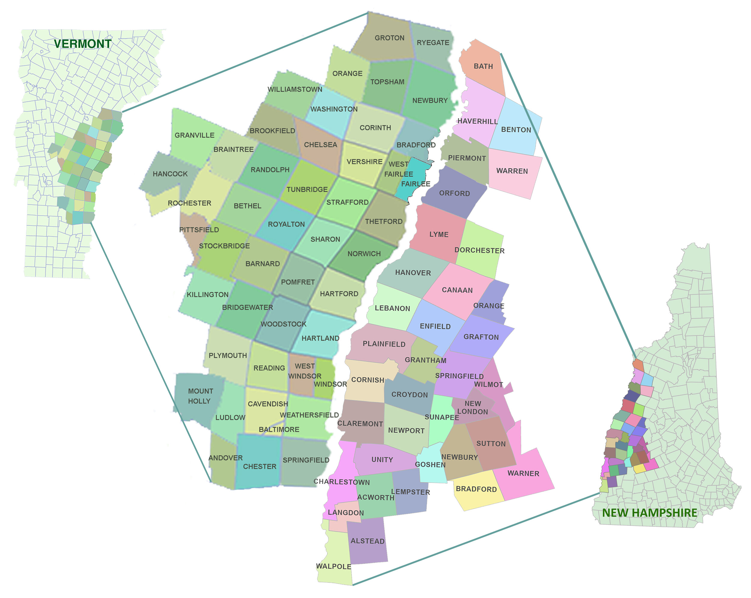
Maps for the 47 Vermont and 36 New Hampshire towns shown are provided below.
VERMONT MAPS
Scroll to bottom of page for New Hampshire Maps
In 2020, LLA added 3 new regional Vermont maps and 47 new Vermont town maps. LLA’s original Vermont 10-Town and updated maps are all available for download below.
Regional Maps and descriptions of how the maps were made are first.
Scroll down to get the town maps. LLA’s original 10-town maps and the 47 updated town maps are all listed below.

2011 LLA ORIGINAL VERMONT 10-TOWN Regional Maps Series
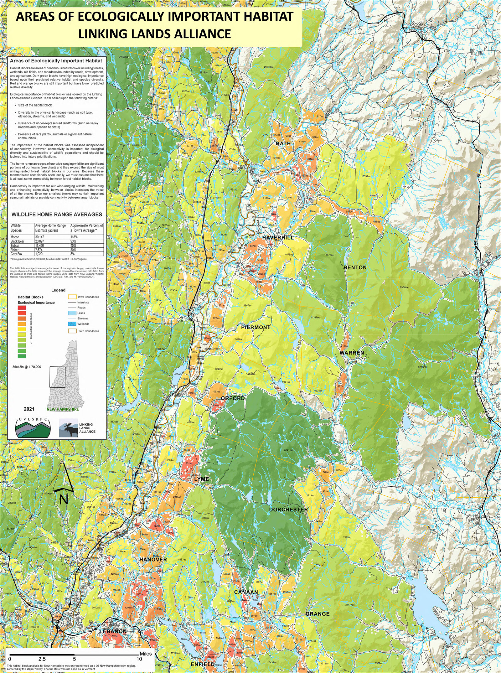
Areas of Contiguous Wildlife Habitat was created by Vermont Fish and Wildlife Department. It shows the 203 habitat blocks in LLA’s 10-town area and categorizes them by size (in acres). The darker the block the larger the number of acres.
Different Types of Landforms was created and used by a team of scientists to determine the Areas of Ecologically Important Habitat.
Areas of Ecologically Important Habitat was created by the team of scientists listed below. They prioritized the 203 habitat blocks in map #1 based on various landscape variables also listed below. The darkest green habitat blocks are predicted to be the best for wildlife.
These are large maps and will take a moment to load.


How were the regional maps made? LLA's 10-town regional maps were a pilot mapping project of the State of Vermont. In 2014 the entire State (4052 habitat blocks) were mapped prioritizing all the blocks in the state using the same variables that were used for LLA’s original maps. The report, Vermont Habitat Blocks and Habitat Connectivity: An Analysis using Geographic Information Systems, details the mapping process, step-by-step, and each variable is described on its own page beginning on page 18.
GIS info: http://geodata.vermont.gov/datasets/VTANR::habitat-blocks-and-wildlife-corridors

Vermont Community Wildlife Program
LLA 10-Town Regional Maps: Thanks to Jens Hawkins-Hilke, Conservation Planning Biologist and Scientist Team.
2019 & 2020 VERMONT Regional Maps
For LLA’s Scientific Maps Go to School expanded area
These maps are prioritized with the State-wide Rating (comparing all 4055 habitat blocks in the State) and for this reason the habitat blocks’ values are different from the 2011 LLA 10-Town Areas of Ecological Importance Prioritized Maps (comparing only 203 blocks).

LLA Vermont Central Region
(4055 habitat blocks prioritized)

LLA Vermont Northern Region
(4055 habitat blocks prioritized)

LLA Vermont Southern Region
(4055 habitat blocks prioritized)
The Vermont State-wide Habitat Blocks are slightly different from LLA’s Original 10-Town Maps

State-wide Regional Map LLA’s Original 10-Town Regional Map
Buffers are different. On LLA’s Original 10-town maps, 330 foot buffers are around buildings and Class 1-3 roads. The buffers vary on the State-wide maps depending on human activity (example, larger buffers around high human activity and smaller buffers around lower human activity).
Habitat Block Size is different. Because the buffers have changed the size of the habitat blocks is usually larger. The large heart-shaped habitat block shown above is 5008 acres on the Original Maps and 5207 acres on the State-wide maps.
Habitat Block Prioritized Values are different. LLA’s Original habitat blocks were prioritized using only the 203 habitat blocks in the original LLA area. The State-wide habitat blocks were prioritized using all 4055 blocks in the state. Note the block in the upper left hand corner, its value (color) has changed from medium green to light green.
Individual Town Maps
The town maps are used for the LLA Scientific Maps Go to School Project but are interesting for anyone wanting a bird’s eye view of the landscape.
Each town in LLA’s original 10-town region (outlined in black on the map) has an individual town map created in 2015 (habitat blocks on these maps were hand edited and for this reason are more accurate than the maps made in 2020).
In 2020, LLA’S Scientific Maps Go to School Project Area expanded, now providing town maps for 47 Vermont Towns!
Outside our area and want to make your own maps so you can use our educational materials? Share these files with your GIS mapper.
2015 Original VERMONT 10-Town maps

2015 Hartland
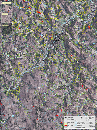
2015 Woodstock

2015 Hartford

2015 Pomfret

2015 Norwich

2015 Sharon
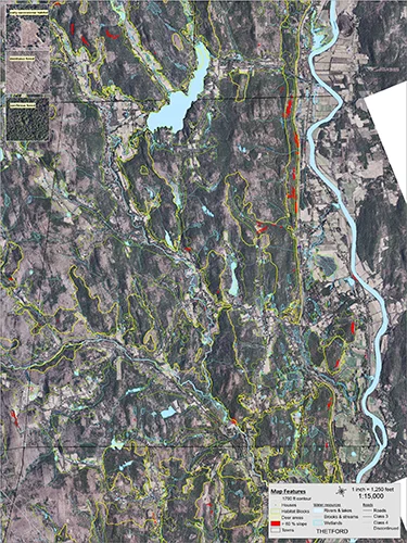
2015 Thetford
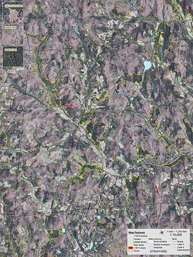
2015 Strafford

2015 Vershire

2015 West Fairlee
2020 VERMONT Town Maps
LLA’s original maps (10 towns) were the pilot project for the State and their habitat blocks were hand edited.
The Habitat Blocks for the entire State of Vermont have now been created. All the town maps generated in 2020 were made using the state-wide blocks. The state-wide habitat blocks were computer generated and as such have a few mistakes (very small triangles and short segments of squiggly lines and there are some buildings that have not been excluded from the habitat blocks).
LLA wishes they were as clean as the original maps but there are 4055 habitat blocks in the state compared to only 203 habitat blocks in LLA’s original 10 towns, so you can understand that it would have taken way too much time to hand edit the entire state.

ANDOVER 2020

BARNARD 2020

BETHEL 2020
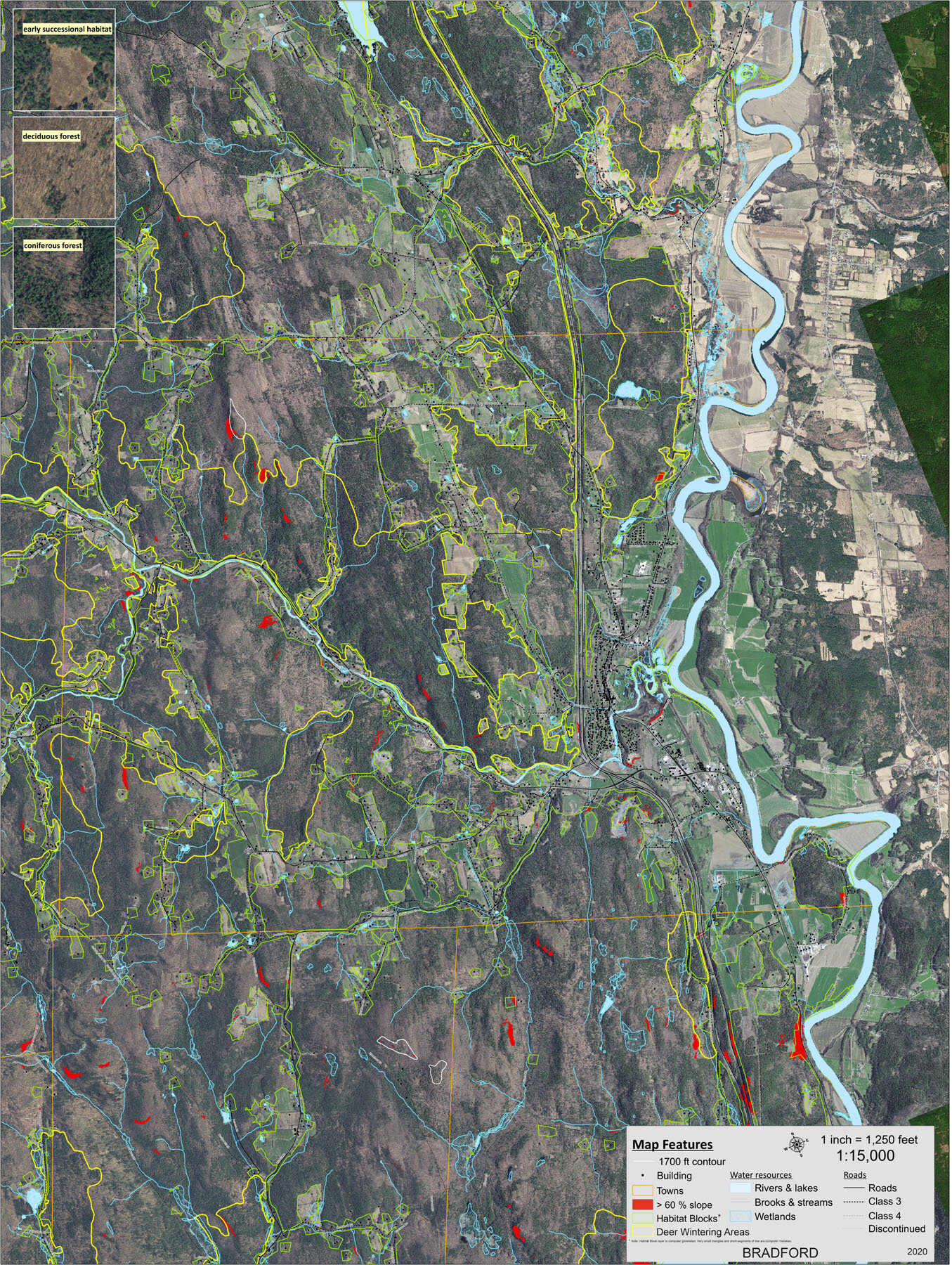
BRADFORD 2020

BRAINTREE 2020

BRIDGEWATER 2020

BROOKFIELD 2020

CAVENDISH / BALTIMORE 2020

CHELSEA 2020

CHESTER 2020

CORINTH 2020
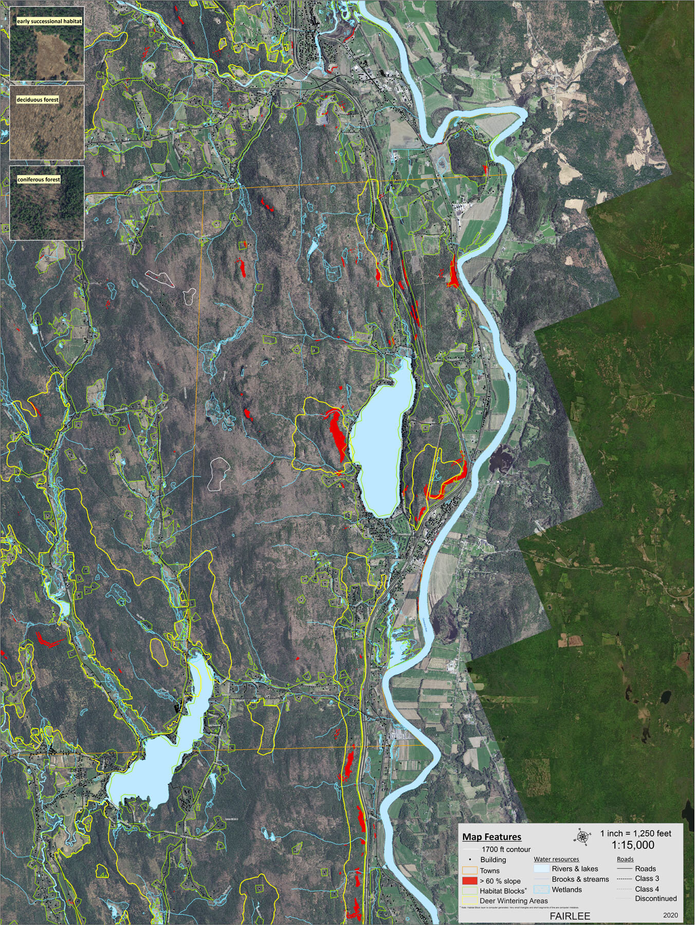
FAIRLEE 2020

GRANVILLE 2020
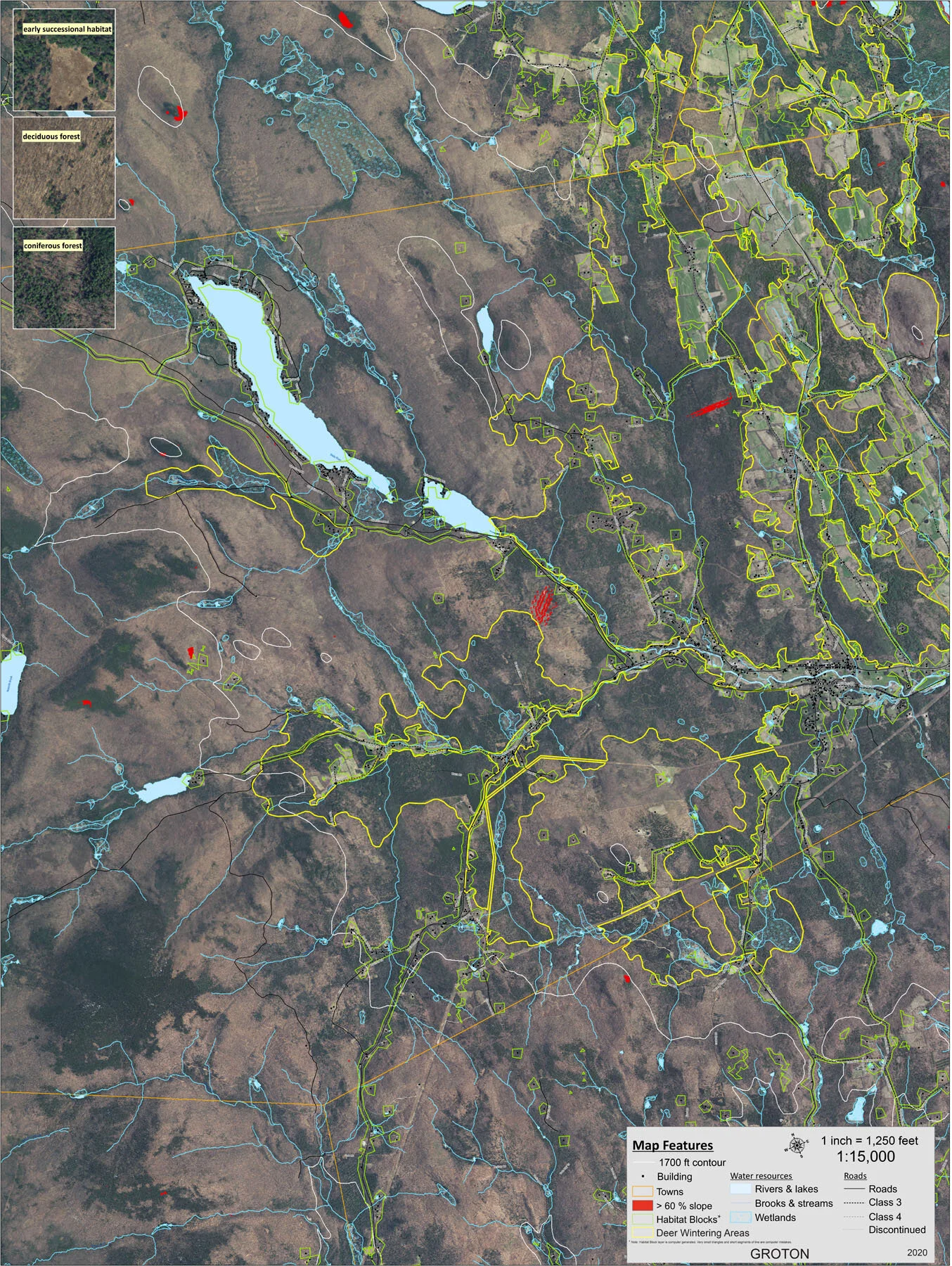
GROTON 2020

HANCOCK 2020

HARTFORD 2020
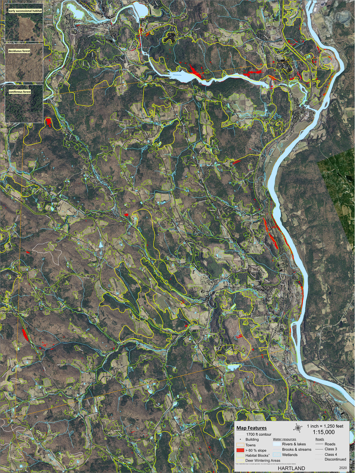
HARTLAND 2020

KILLINGTON 2020

LUDLOW 2020

MOUNT HOLLY 2020

NEWBURY 2020

NORWICH 2020
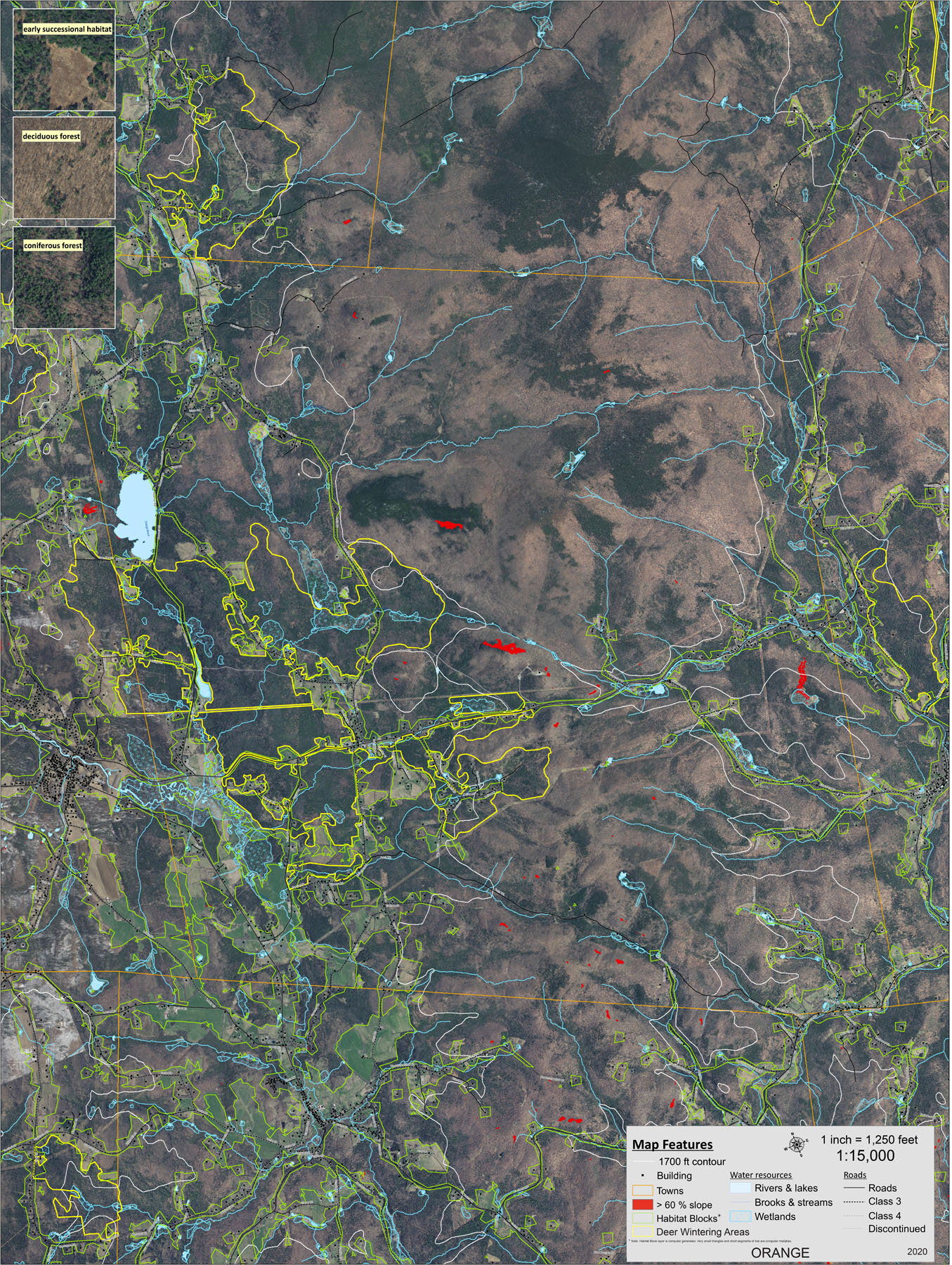
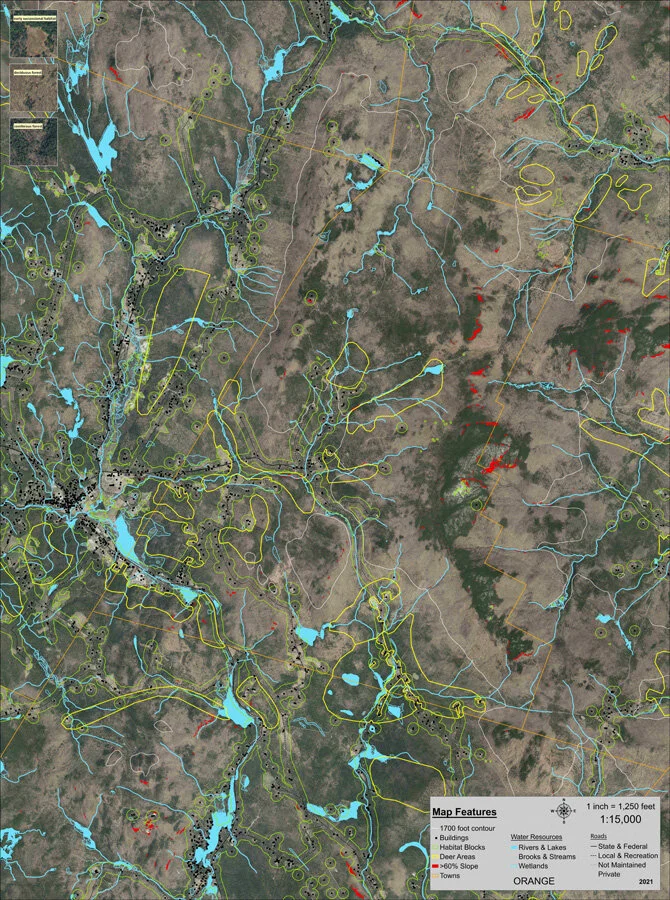
ORANGE 2020

PITTSFIELD 2020

PLYMOUTH 2020

POMFRET 2020

RANDOLPH 2020

READING 2020
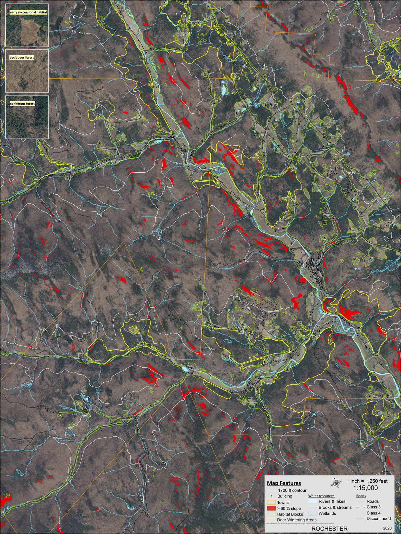
ROCHESTER 2020

ROYALTON 2020

RYEGATE 2020
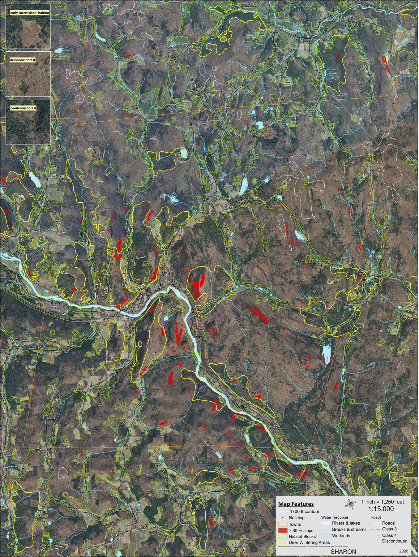
SHARON 2020
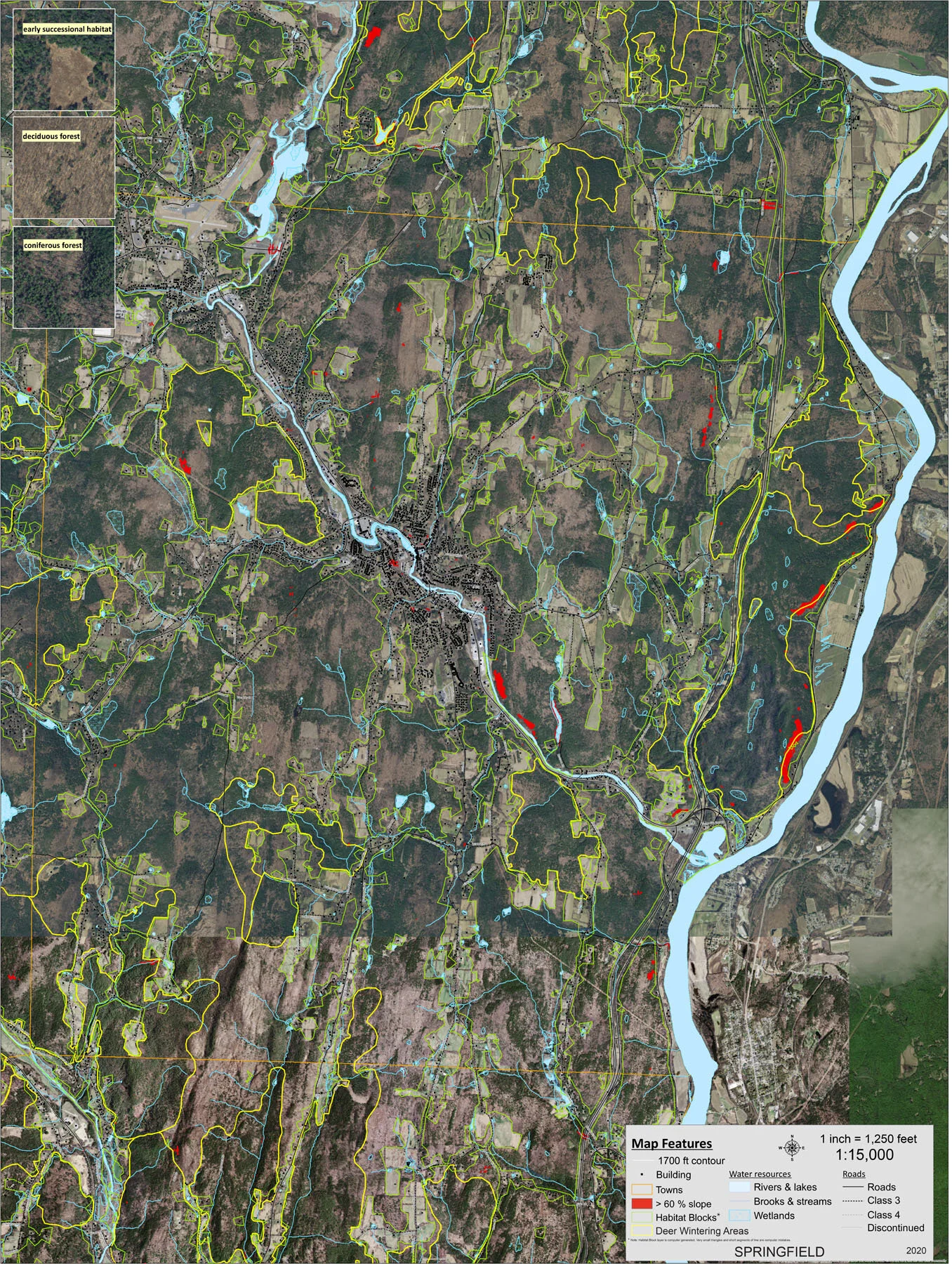
SPRINGFIELD 2020

STOCKBRIDGE 2020
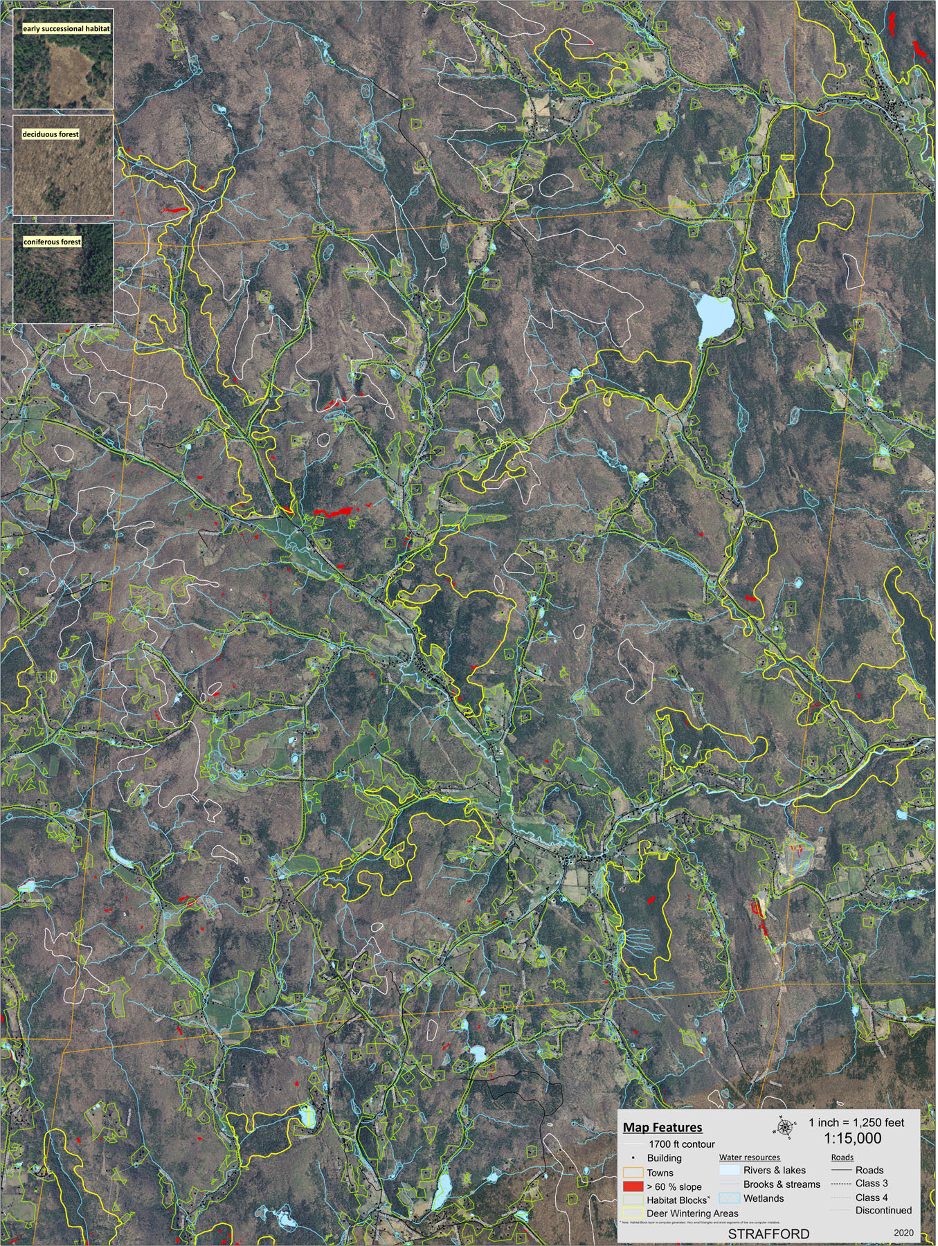
STRAFFORD 2020

THETFORD 2020

TOPSHAM 2020
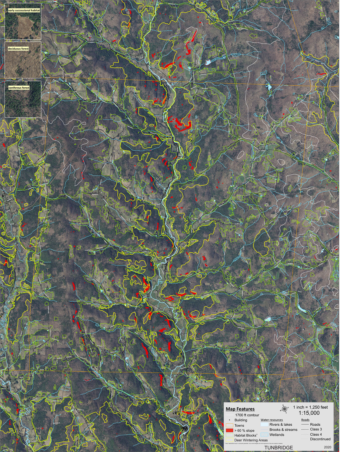
TUNBRIDGE 2020

VERSHIRE 2020

WASHINGTON 2020

WEATHERSFIELD 2020
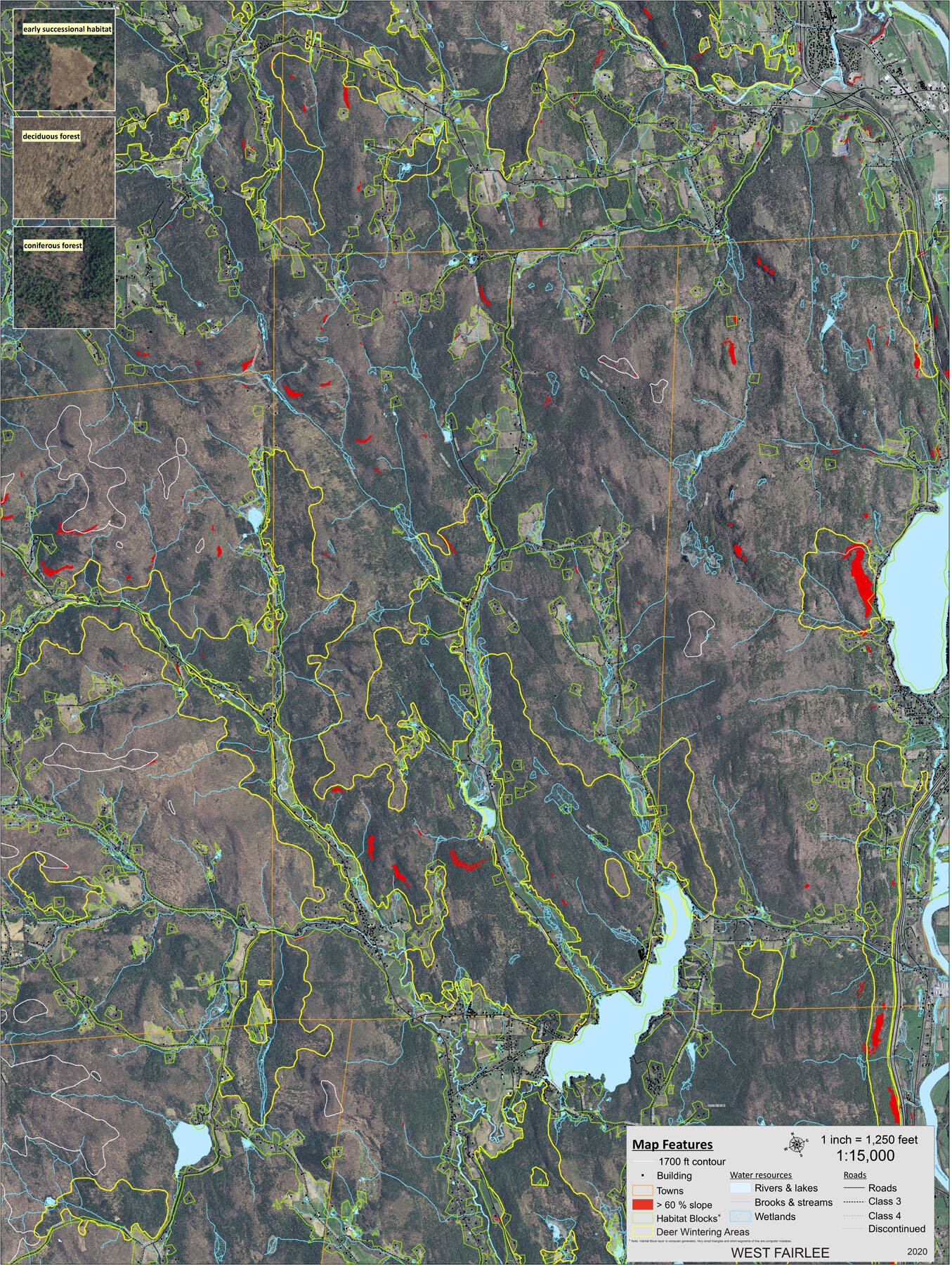
WEST FAIRLEE 2020

WEST WINDSOR 2020

WILLIAMSTOWN 2020
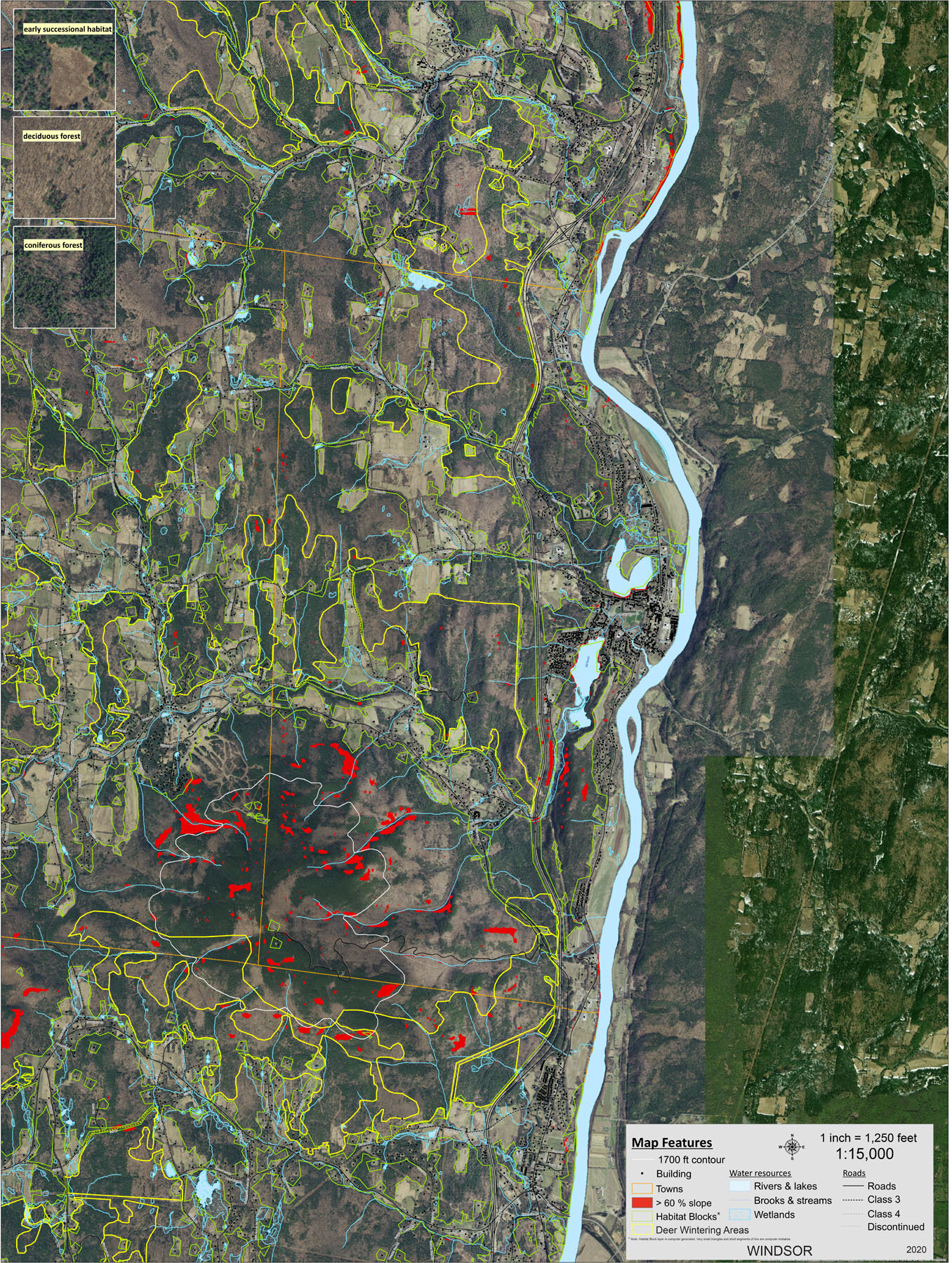
WINDSOR 2020

WOODSTOCK 2020
New Hampshire Maps
LLA’s 2021 mapping project expands our geographic area into the neighboring Greater Upper Valley region of New Hampshire. To do so, this project adapted the spatial analysis model performed in Vermont to this New Hampshire region. More information on the importance of habitat blocks to ecosystem functioning can be found in the Vermont Habitat Blocks and Habitat Connectivity report (VT Fish and Wildlife, 2014). The objectives of the project include:
❖ Identify habitat blocks using best-available Geographic Information Systems (GIS) data and accepted scientific methods.
❖ Rank the habitat blocks for their biological and conservation value (also called “ecological importance”).

36 Upper Valley New Hampshire Towns mapped in 2021
NH REGIONAL MAPS
NORTHERN NH 36 TOWN REGION

CENTRAL NH 36 TOWN REGION

SOUTHERN NH 36 TOWN REGION

See How NH LLA Maps Were Made to learn more about methods used for the New Hampshire analysis.
NH TOWN MAPS

ACWORTH

ALSTEAD
BATH

BENTON

BRADFORD

CANAAN

CHARLESTOWN (NORTH)

CLAREMONT
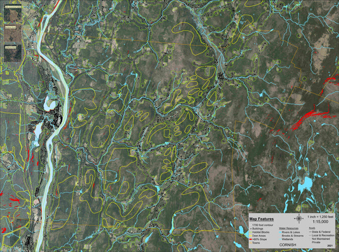
CORNISH

CROYDON
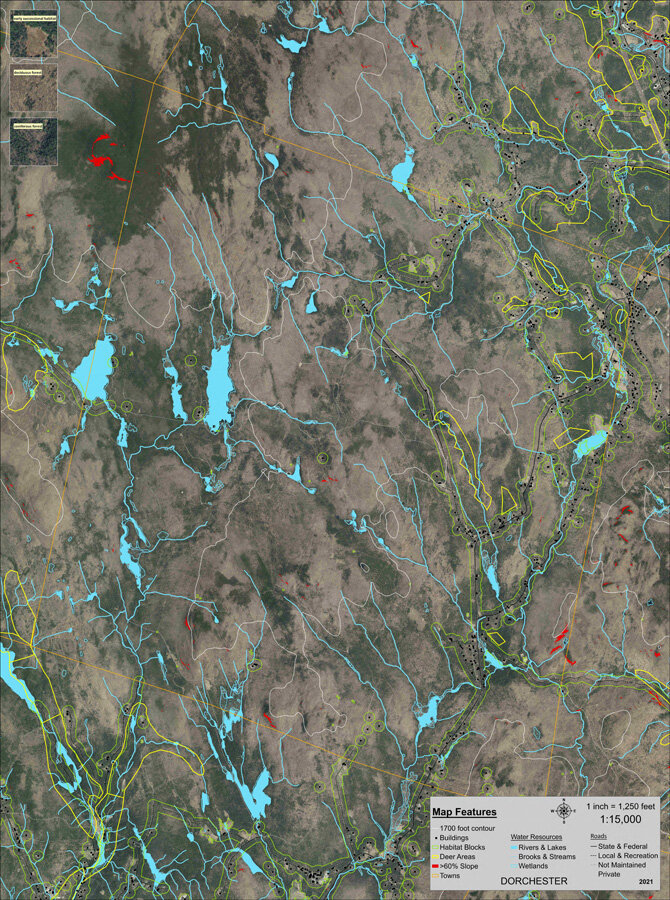
DORCHESTER

ENFIELD

GOSHEN

GRAFTON

GRANTHAM

HANOVER

HAVERHILL

LANGDON /
CHARLESTOWN (SOUTH)

LEBANON

LEMPSTER

LYME

NEW LONDON

NEWBURY

NEWPORT
ORANGE

ORFORD

PIERMONT

PLAINFIELD

SPRINGFIELD

SUNAPEE

SUTTON

UNITY
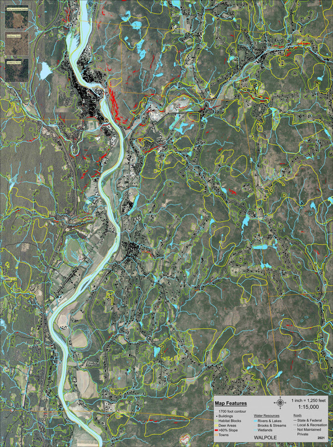
WALPOLE

WARNER

WARREN
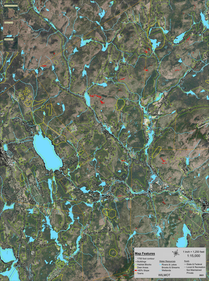
WILMOT
Special thanks to the following organizations. Their support enabled LLA to expand from its original 10 Vermont towns to 47 Vermont towns and 36 New Hampshire towns.

Two Rivers-Ottauquechee Regional Commission
All Vermont Town Maps and 3 New Regional Maps: Thanks to Pete Fellows
Upper Valley Lake Sunapee Regional Planning Commission
All New Hampshire Mapping: Thanks to Olivia Uyizeye
Thanks to Mascoma Bank for providing matching funds to create:
Vermont’s 23 new Town Maps and 3 New Regional Maps (2018)
New Hampshire’s 36 Town Maps and 2 Regional Maps (2020)

Coop Food Stores’ Pennies for Change Program
Thanks to the Coop Food Stores Pennies of Change Program and their generous shoppers for providing the matching funds for LLA’s New Hampshire Maps

Thanks to Staples in West Lebanon for giving LLA a discount on map printing