Working with Schools
LLA branches out, providing our maps and educational materials to schools in our region.

LLA’s SCIENTIFIC MAPS GO TO SCHOOL
In 2017, LLA received a Wellborn Ecology Fund Grant to support our pilot project working with teachers from the following schools: Thetford Academy, Woodstock Union High School, Newton School in Strafford and Sharon Academy.
The grant allowed us to:
Meet with the teachers to learn about their classes
Provide each teacher with large format, durable town maps and LLA’s 10-town regional maps
Hire an educational consultant well versed in Next Generation Science Standards (NGSS) to create curriculum for the teachers as well as a detailed teacher training packet with a template for the teachers to create their own curriculum
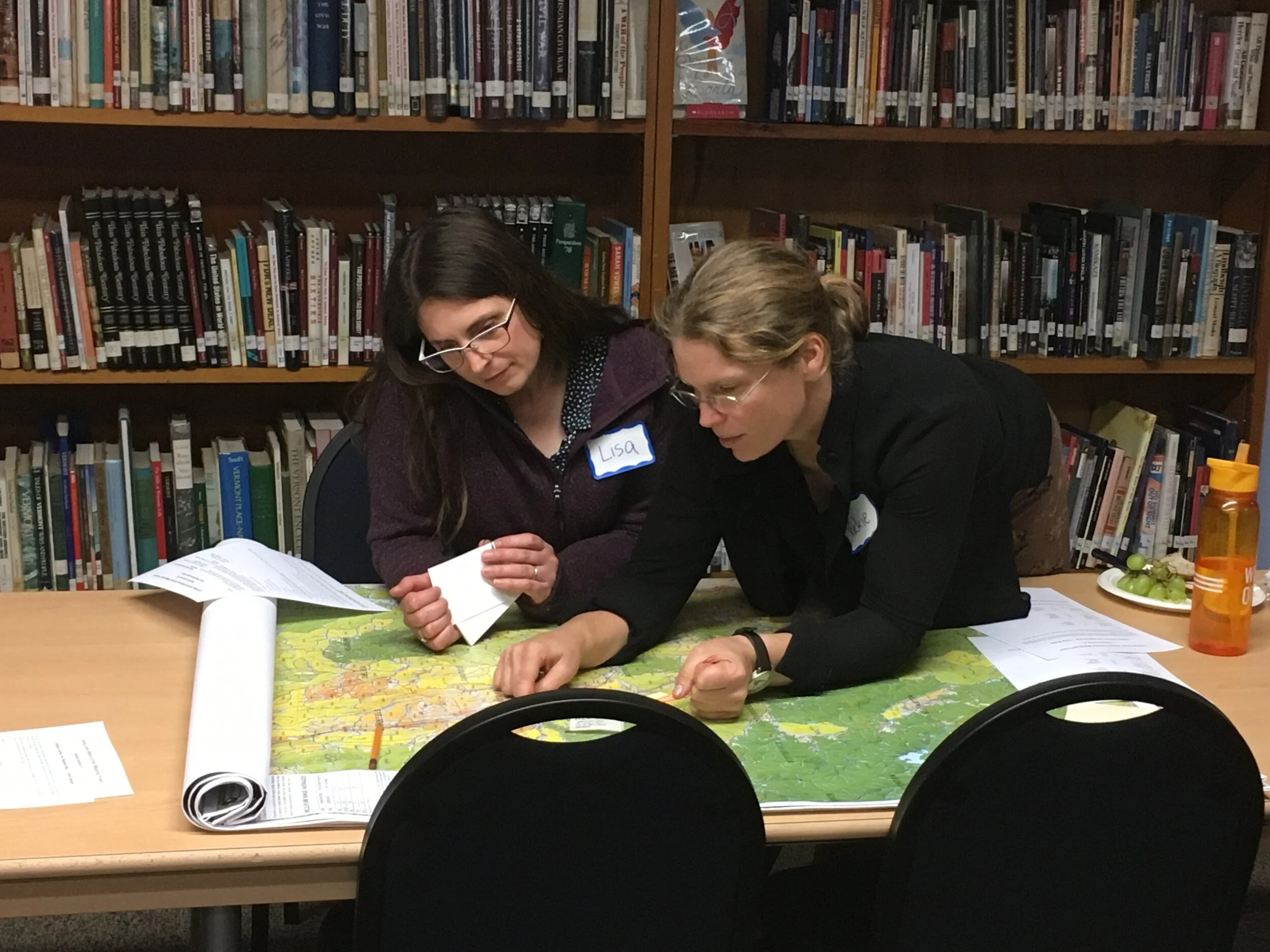
Hold a teacher roundtable to learn how teachers were using their maps and go through the educational packet and resources available on this website (ie: videos and teacher forum, an interactive site for teachers to exchange ideas)

Using LLA’s maps in classrooms puts lessons into perspective – making them real – enabling students to tie their lessons to their backyard and towns.
2017 Teachers' Comments:

“I used the maps during units on scale/models and while teaching about migration/land management choice.”
“Unit looked at moose and trout population. Maps provide basis for initial work looking at habitat. Students evaluated the solutions put in place to address moose population decline.”
“The maps are valuable because they are a concrete example of how we are impacting habitat. You can’t really see the fragmentation until you look at the bigger picture. It is valuable to have students get familiar with them [the maps] and then have them around the room for the duration of the unit so you can keep referring back to them and discussing them as you go.”
LLA’s SCIENTIFIC MAPS GO TO SCHOOL 2
In 2018, LLA was fortunate to receive another Wellborn Ecology Fund Grant and will be working with teachers serving these six towns: Hartland, Pomfret, Vershire, West Fairlee, Norwich and Hartford.
This year we will:
Provide each teacher with large format durable town maps and LLA’s 10-town regional maps
Hold a teacher roundtable to introduce teachers to the educational materials developed last year and to the resources available on this website
Hold an early summer curriculum development workshop for teachers from all ten towns. All teachers’ projects will be added to our website’s Teacher Forum.

LLA’s SCIENTIFIC MAPS GO TO SCHOOL
Project expands to 37 VT Towns & 36 NH TOwns
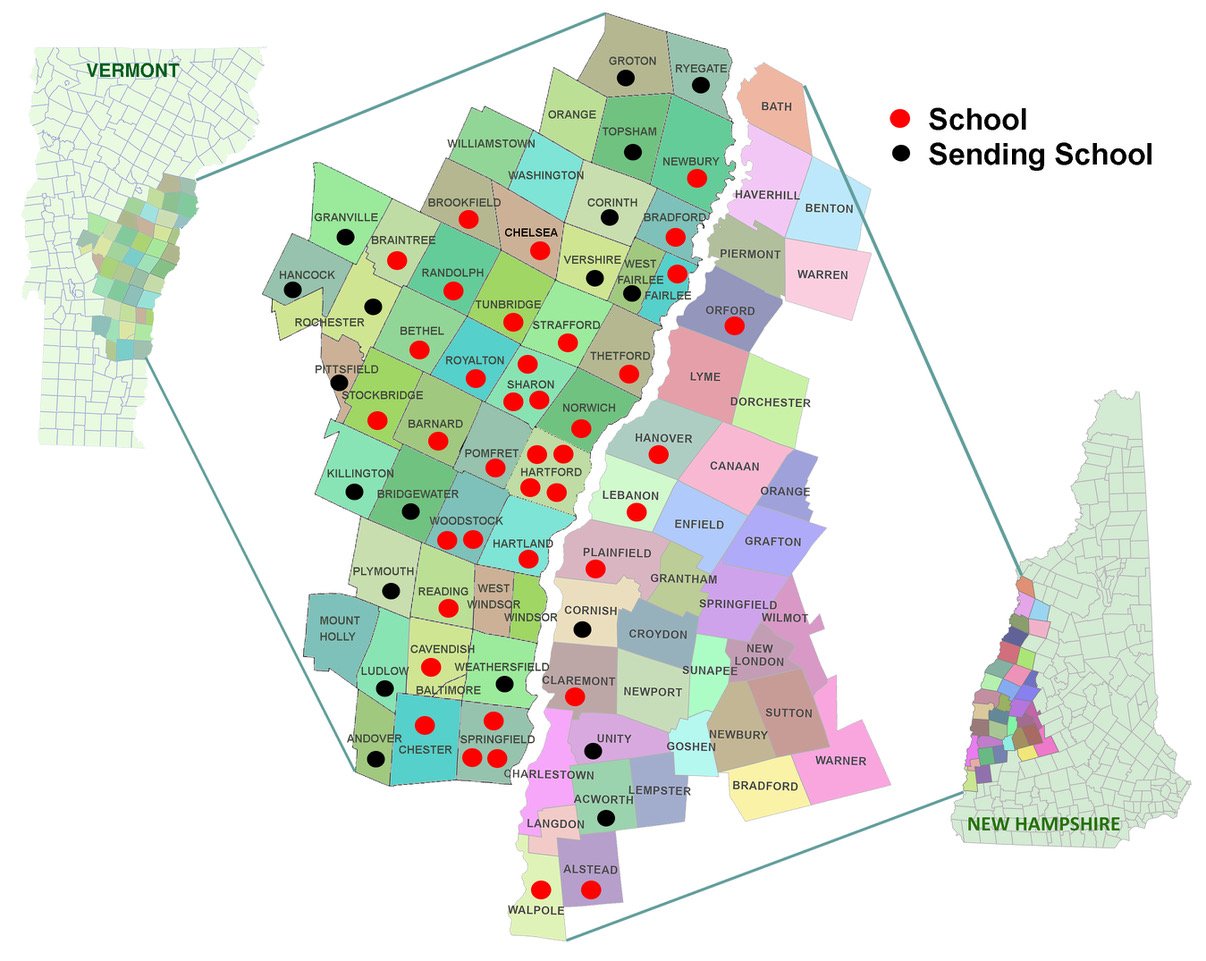
2017-2022 Schools/Towns where we have partnered with teachers.
We work with new teachers every fall. Contact us if you would like maps for your school.
LLA Scientific Maps go to School Project continues to partner with teachers in VT and NH.
We:
Provide each teacher with LLA’s large format durable town maps and regional maps
Hold a teacher orientation to introduce teachers to LLA’s educational materials and resources including; LLA’s maps, educational materials developed by an NGSS expert and resources available on this website.
Contact us, if you would like to partner with LLA. Linkinglands@gmail.com
Teachers and Students using LLA’s Maps


LLA’s Maps in use at local schools 2020

Elementary students in 2020
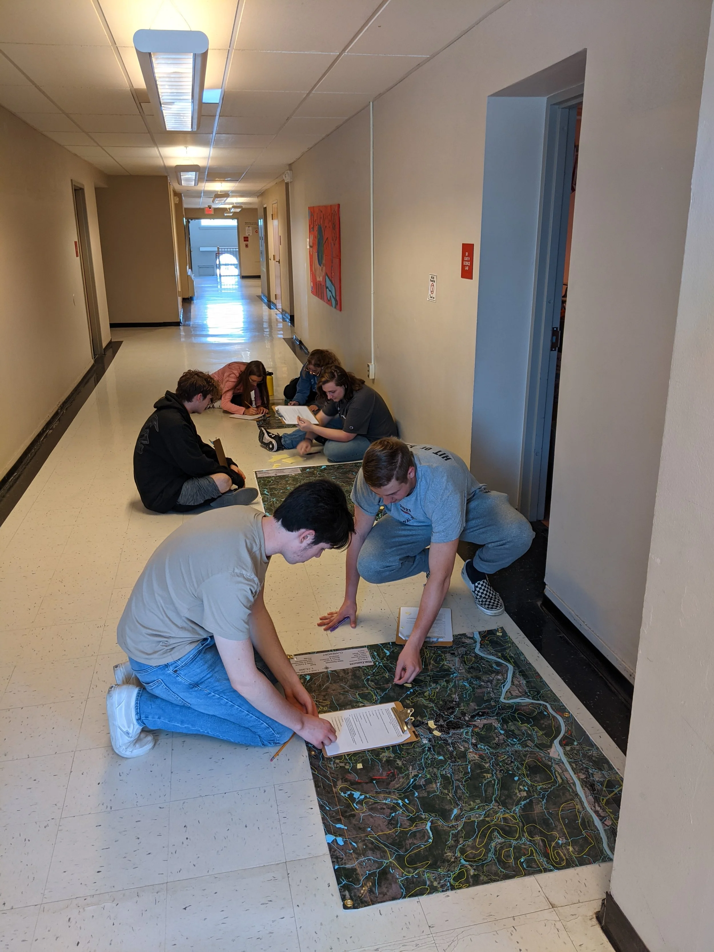
High school students in 2021
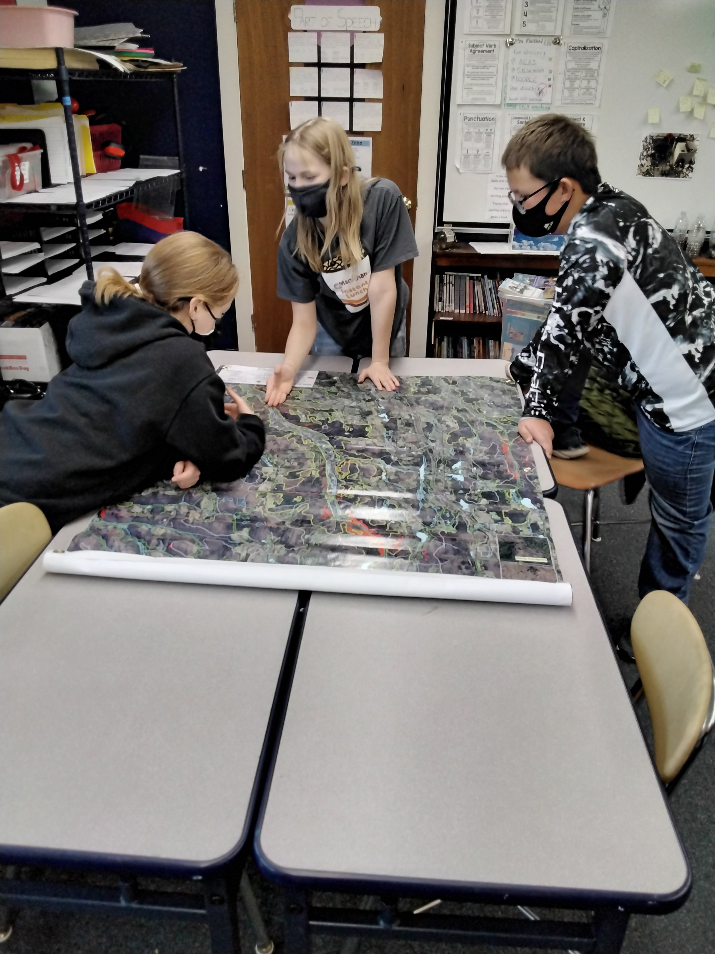
Middle schools students in 2021
teacher RESOURCES
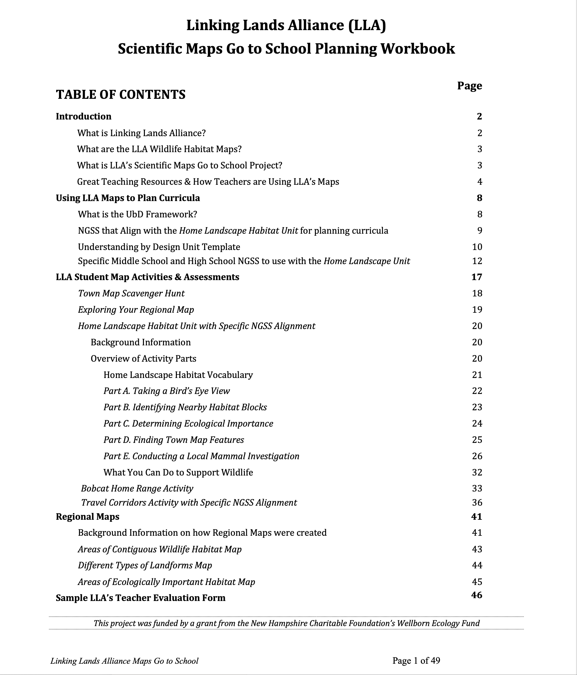
LLA Map Activities Explore Your Regional Map; Town Map scavenger hunt; Bobcat Activity; NGSS Travel Corridors; 5-part NGSS Home Landscape Unit
Map Activity Samples
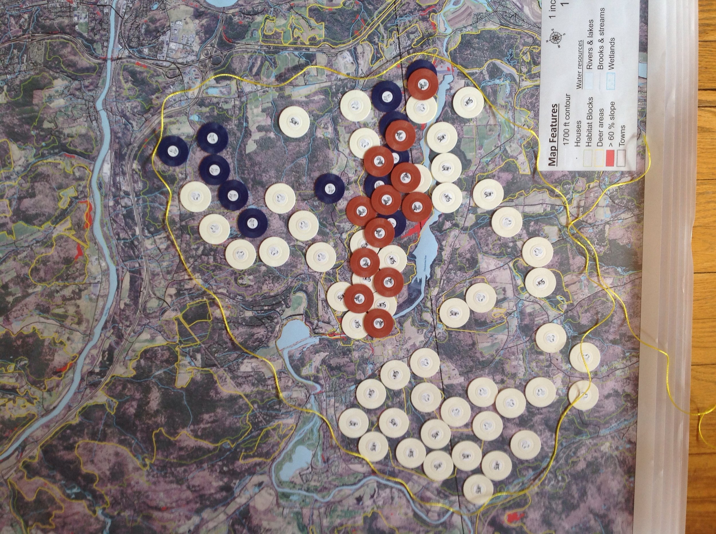
Calculate range of a bobcat based on prey species using Town map
Travel Corridor NGSS activity uses Regional Map
Wildlife Range Transparencies to use with regional maps
How Much Land Do a Moose, Bear and Bobcat Require? To use with the transparencies.
Teacher Forum where teachers share how they are using LLA's maps
How teachers are using LLA’s maps
Species Loss with Fragmentation
Our Vermont Woods Information, programs, and partners to assist you in sharing the woods with students.
NH Wildlife Education provides high-quality professional development for teachers, and our school-based programs align with the Next Generation Science Standards.
NH Teacher Curriculum Resources from NH Fish and Game.
NH Curriculum Resources for the Watershed Education Program from NH Fish and Game.
Keep Forests Healthy The tool provides a rapid and simple process to assess forest resiliency. This publication contains background information on important characteristics of resilient and healthy forests and examples of potential adaptation strategies. It is accompanied by a scorecard to be used in the field to evaluate the resiliency of a forest.
The Resilient Forest Series by Northern Woodlands Linked print, audio and video works that explore the relationships and traditions that have helped keep forests intact. The series will also consider how human and natural communities are adapting to change.
Vermont Conservation Design Maintaining and enhancing ecological function across the landscape is fundamental to conserving biological diversity.
Northern Woodlands Goes to School program provides classroom teachers with free digital copies of the magazine. Current teachers and homeschooling parents are welcome to sign up.
Wildlife Management and Outdoor Education Techniques for Educators
Introduction to the Next Generation Science Standards video by Bozeman Science
The Understanding by Design guide to creating high-quality units. Wiggins, G., & McTighe, J. (2011). Alexandria, VA: ASCD.
Visit our Educational Material page for more fun and educational links
Explore and share your students’ observations from the natural world
iNaturalist Contribute to Science. Every observation can contribute to biodiversity science, from the rarest butterfly to the most common backyard weed. We share your findings with scientific data repositories like the Global Biodiversity Information Facility to help scientists find and use your data. All you have to do is observe.
Journey North Post your sightings and follow migrations of Monarchs, Birds and other animals
Thank you for making this work possible!

Staples provides discounts for LLA Map Printing
New Hampshire Charitable Foundation
LLA's Where Wildlife Roam and Scientific Maps Go To School Projects were funded by grants from the New Hampshire Charitable Foundation’s Wellborn Ecology Fund.

Food Donations for Scientific Maps Go To School Teacher Roundtable

Food Donations for Scientific Maps Go To School Teacher Roundtable
Vermont Fish and Wildlife Department
Donated educational materials for Teacher Roundtable

Food Donations for Where Wildlife Roam presentations

Providing Teacher Support

The Place You Call Home Donation